
|
Home | Privacy Policy | ShoreZone Page | Metadata | ShoreZone.org | Contact |
Shore Type: Organic Shorelines, Marshes, and Estuaries (BC Class 31) Southeast Alaska
 |
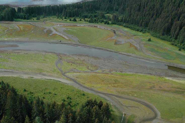 |
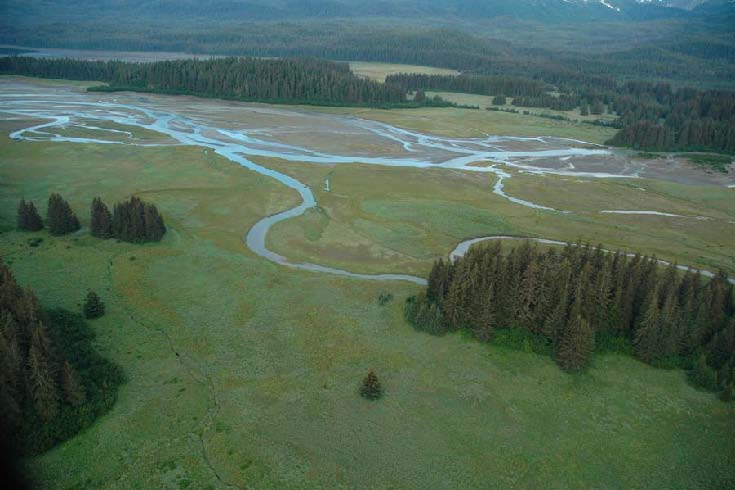
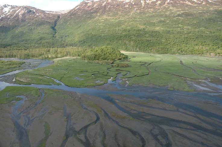
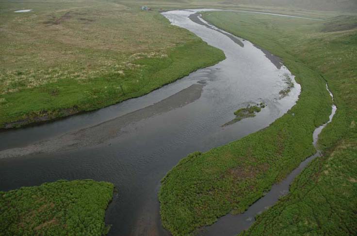
| Estuary
with forms of high marsh (“Mh”),
low continuous marsh (“Mlc”), river with multiple channels (“Rm”), and tidal flats with multiple bars and channels (“Ttbs”) |
Estuary with forms of high marsh (“Mh”), low continuous marsh (“Mlc”), river with multiple channels (“Rm”), and tidal flats with multiple bars and channels (“Ttbs”) |
| St. James Bay, Lynn Canal (Unit 10/04/2105) | North Passage, between Icy Strait and Sitakaday Narrows (Unit 10/03/4845) |
| SE05_ML_0117.jpg | SE05_ML_1695.jpg |
Shore Type: Organic Shorelines, Marshes, and Estuaries (BC Class 31) Southeast Alaska
 |
 |
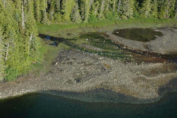
| Unit with
mapped Forms of high (supratidal) marsh (“Mh”),
low, discontinuous marsh (“Ml”), and delta flat (“Df”) comprised of boulders and cobbles and overlying pebbles and sand (Material “Cbc/Cps”). This unit is BC class 31 owing to the obvious encroachment of organics into the intertidal zone. |
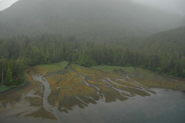
Unit mapped with Forms for brackish, supratidal, and mid to low marsh (“Msl”), tidal flat with channels, pools, and bars (“Ttcpb”), a delta fan (“Df”), and multiple river channels (“Rm”), classified as a BC class 31 owing to the estuarine environment. |
| Duke Island, SE Alaska (Unit 12/04/5367) | Mary Island, SE Alaska (Unit 12/07/3288) |
| SE06_MM_09728.jpg | SE06_MM_24170.jpg |
Shore Type: Organic Shorelines, Marshes, and Estuaries (BC Class 31, continued) Kodiak Archipelago
 |
 |
| A high
marsh with ponds and a drowned forest (Form
“Mhof”) is mapped in this unit, along with a delta fan with multiple channels (“Dfm”) and a river with multiple channels (“Rm”). |
A high marsh (Form “Mh”) and tidal flat (“Tt”) are features of this estuary, classified as an organic shoreline (BC Class 31). |
| Zachar Bay (Unit 06/03/5300) | Ayakulik Island (Unit 05/01/0075) |
| KDKavi05_4114.jpg | KDKavi05_5610.jpg |